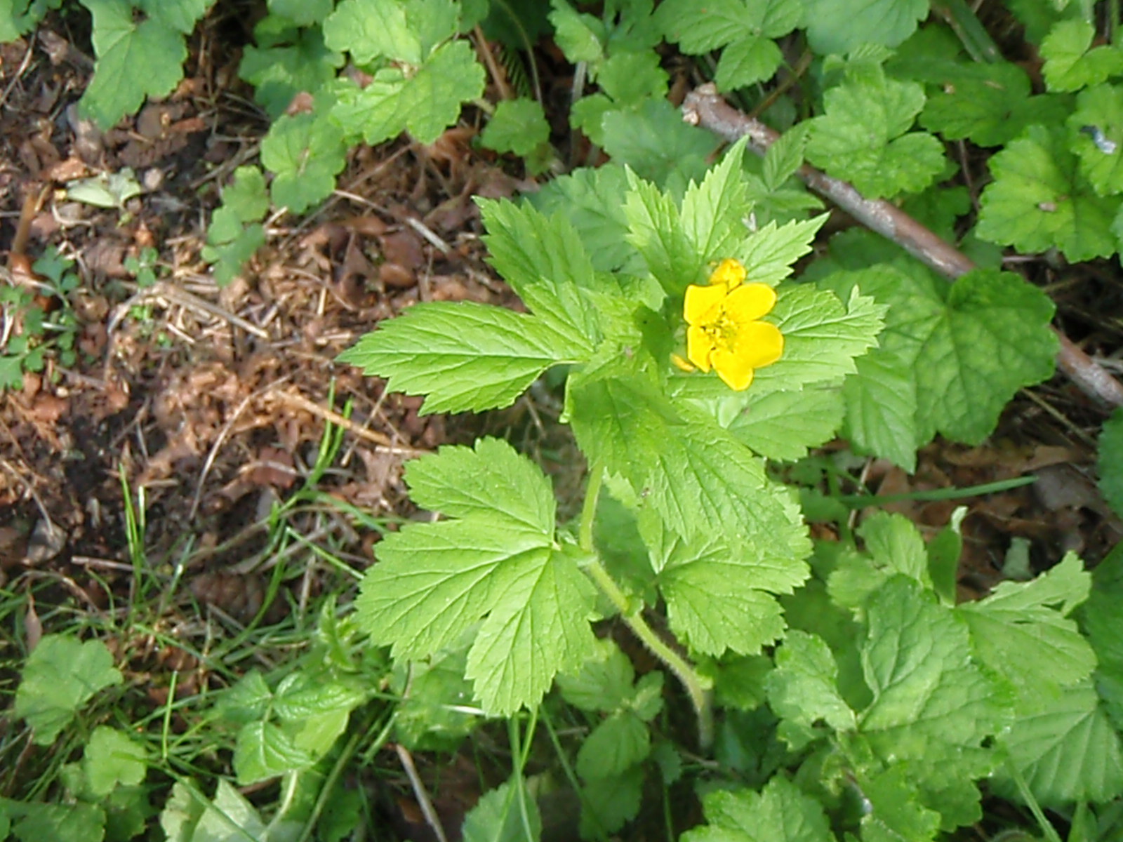
Today's trail is located at Bonesteele County Park, located along the Aumsville Highway. The main trail head is located next to the eastern end of the parking lot, and descends into a wooded section on the property as it leaves a short dirt road that is gated off. Of course, many people start by walking uphill on that road instead of taking the slightly hidden trail. As you enter the forest on this trail, you come across a boardwalk that passes Spring Wildflowers.
As the trail continues, you will find that after walking uphill a short ways, the trail splits into two. The left trail will take you up to a section of forested hillside that is bordered by boulders before connecting with that short road that leads you back to the parking lot.
The right trail will take you out of the small forest and to another split in the trail. Taking a left here will follow the edge of the woods and down to the parking lot, while a right will take you around the perimeter of the rest of the park and offer a view of Mount Jefferson. The field located on the property also has many trails that cross it. For those of you that want to bring Fido, this park allows it as long as the dog remains on a leash and it's poop is picked up. With so many trail combinations to choose from, you and your pet can hike as little or as long as your dog is willing to go.
Showing posts with label Trail Talk Thursdays. Show all posts
Thursday, May 15, 2014
Thursday, May 8, 2014
Trail Talk Thursday #13
Today's trail is a small, 0.2-mile trail along Hullt Creek in Silver Falls State Park. Located along the Canyon Trail, the trail head for this short trail takes visitors a short distance to the base of Double Falls. Of course, to get to this small trail, you would need to hike 1.1 miles from the Winter Falls Parking Lot, 2.1 miles from the Historic South Falls Lodge starting on the Maple Ridge Trail, or 2.1 miles from the North Falls Parking Lot. Either way, this small trail is just an add-on to the Canyon Trail.
Thursday, April 17, 2014
Trail Talk Thursday #12
This week's trail is located at Silver Falls State Park and is known as the Campground Trail. At roughly 1 mile in length, it encircles half of the campground with a trail head near the Ampitheater. As visitors walk along this trail, they can take in the sights of wildflowers, sounds of native birds, and may even see a few salmonberries ripe for the picking. A small stream drains a basin located between this trail and the campground and one can see that beavers had once been at work damming it up, yet no beaver lodge can be seen from the trail. A blind located next to one of these dams allows visitors to peer into a beaver pond without scaring the birds away.
The beaver pond between the trail and the campground.
Thursday, March 13, 2014
Trail Talk Thursday #11
Thursday, March 6, 2014
Trail Talk Thursday #10
St. Louis Ponds Trail
Just across the highway from Gervais is a county park with a trail looping through
it. This short trail, which has no name, winds around one maze-like pond and past five others within St. Louis Ponds County Park.
The maze-like ponds were created when earthen material was needed for the highway which passes along the eastern edge of the park. As you hike along this small trail, you may see birds such as the American Robin, trees that have been felled by beavers, and local fisherman. Most of the trail is paved, making it ADA accessible, but the rest is gravel or dirt. This park is nice during late winter, but I bet looks even better from Spring through Fall.
Thursday, May 16, 2013
Trail Talk Thursday #9
Canyon Trail
This 3.9-mile trail takes you from South Falls through the canyon, hence its name, to North Falls. From the South Falls, instead of going back up to the lodge, this trail takes you along the South Fork of Silver Creek until you get to Lower South Falls. At this point along the trail, a series of switchbacks that are mostly stairs lead you deeper into the canyon and under the waterfall, much like South Falls, except there is a stone wall instead of a fence. If you were to come during Winter or early Spring, you would find a bit of water flooding the pathway behind Lower South Falls up to a few inches deep. Continuing on down the trail will bring you to the intersection with the Maple Ridge Trail, roughly 1 mile from the bridge below South Falls. At this intersection, there is a trail sign and bench that allows hikers to decide which way they want to go, and to rest if necessary. For those that are getting tired, it is recommended that you go back via the Maple Ridge Trail.
Lower South Falls
From this intersection, the Canyon Trail dips into the North Canyon alongside the North Fork of Silver Creek. At roughly three-quarters of a mile from the intersection, a bridge will take hikers across to the other side. At this spot, fishermen come to try their luck at getting small Brook Trout is summer. Just upstream is Lower North Falls, a favorite in Autumn for the multi-colored Vine Maples that go perfectly with the 30-foot cascade.
Lower North Falls
As you travel past the Lower North Falls, there is an additional 0.2-mile round trip hike along Hullt Creek that brings you to Double Falls, the only waterfall in the park that is split in two by a ledge, creating a double waterfall. This waterfall also has another claim to fame, being that it is the tallest waterfall in the park at 177 feet high.
Double Falls
From Hullt Creek to the intersection with the Winter Trail, a half mile upstream, there are two more waterfalls: Drake Falls, named after the photographer that brought attention to the area; and Middle North Falls. A short trail takes visitors behind the Middle North Falls. In fact, the rock layers above, beside, and under this trail are the same as the ones at the Lower South Falls. The intersection with the Winter Trail provides the weary a shortcut back to their vehicle; but be warned, there is a steep hill next to Winter Falls.
Middle North Falls
If you feel like going on, the next waterfall you will see is Twin Falls, named so because it flows over the same rock in two places. A trail that connects here will take you to the North Fall Group Campground. From Twin Falls to North Falls, many boulders line the creekbed, some as large as a bedroom. These massive boulders fell off of an ancient rock ledge, much like the ledge at North Falls. Once you get to North Falls, you can see some smaller boulders at the base of the waterfall. These likely fell off sometime in the last millenium.
Twin Falls
Under the North Falls, a cavern has allowed people to walk through it for centuries. Native American artifacts have even been found in the dirt here. If you have a flashlight, shine it up one of the holes in the cavern's ceiling; these shafts are actually the casts of ancient trees that were burned up as the lava solidified around it over 14 million years ago. Once past the cavern, a series of stairs will lead you out of the canyon and to the intersection with the Rim Trail and the Upper North Trail. The Rim Trail will take you back to the South Falls Day Use Area.
North Falls
So if you're looking for a moderate day hike within an hour of Salem, check out the Canyon Trail at Silver Falls State Park. Until next time, get outside and and enjoy hiking on one of the many trails in the great Oregon Outdoors.
If you feel like doing the full Trail of Ten Falls, before taking the Rim Trail, hike the Upper North Falls Trail. Winter Falls can be seen with a side trip either from the canyon trail or the rim trail. The full Trail of Ten Falls is about 7 to 8 miles, depending on which way you want to go to Winter Falls. For those of you who to attempt the Trail of Ten Falls and succeed, there is a bumper sticker at the Nature Store that you can get to let everyone know that you survived the Trail of Ten Falls.
Thursday, May 9, 2013
Trail Talk Thursday #8
Just south of Aumsville (that little town between Salem and Stayton that has a skateboard park) is a county park with a trail looping through it. That trail, which has no name, winds this way and that around Young Lake in the Aumsville Ponds County Park. Besides viewing Young Lake from several spots, the trail, which I will call Young Lake Trail, also allows hikers to view two small ponds which also do not have a name. If you are lucky, like I was the day I went hiking on this trail, you might see deer and uncommon birds, such as the Red-winged Blackbird. Other birds that were seen there included a Great Blue Heron, Canadian Geese, and many smaller birds that like to hide in the marshes.
So if you're looking for a short hike within 30 minutes of Salem, check out either the trail around Young Lake at Aumsville Ponds County Park. The parking is on the north side of the park - off of Bates Road. Until next time, get outside and and enjoy hiking on one of the many trails in the great Oregon Outdoors.
The trail starts out here (parking is off to the left, Young Lake is on the right)
One of the small ponds that is along the trail
Another small pond...
Young Lake (the bridge on the other side is part of the trail)
Young Lake (you can just see the second foot bridge on the other side)
A Great Blue Heron was standing near the first bridge
So if you're looking for a short hike within 30 minutes of Salem, check out either the trail around Young Lake at Aumsville Ponds County Park. The parking is on the north side of the park - off of Bates Road. Until next time, get outside and and enjoy hiking on one of the many trails in the great Oregon Outdoors.
Thursday, May 2, 2013
Trail Talk Thursday #7
If you are looking for a short hiking trail like no other here in the Mid-Willamette Valley, you really do not have to look far. Just south of Salem, the Ankeny National Wildlife Refuge has several trails that get you off the ground and on a boardwalk that takes you through the trees and over streams to bird viewing blinds that allow hikers to watch birds without disturbing them. The Rail Trail takes hikers on a boardwalk through an Oregon Ash Wetland, while the Pintail & Egret Marsh Boardwalk takes hikers through a lowland forest to the Pintail and Egret Marshes. It is here along this boardwalk where you can here the birds calling through the woods as the trail meanders left and right through the trees before coming into the open marshes at the observation area. For those that come at the right time, you may be able to see some of the amphibians that inhabit the region, but you have to be quiet if you want to see them.
So if you're looking for a short bird-watching hike in the mid-Willamette Valley, check out either the Rail Trail or the Pintail & Egret Marsh Boardwalk at the Ankeny National Wildlife Refuge. Until next time, get outside and and enjoy hiking on one of the many trails in the great Oregon Outdoors.
The Pintail & Egret Marsh Boardwalk
So if you're looking for a short bird-watching hike in the mid-Willamette Valley, check out either the Rail Trail or the Pintail & Egret Marsh Boardwalk at the Ankeny National Wildlife Refuge. Until next time, get outside and and enjoy hiking on one of the many trails in the great Oregon Outdoors.
Thursday, April 25, 2013
Trail Talk Thursday #6
Oregon Grape
Blackberry
Salmonberry
Eagle creek
So if you're looking for a short hike in the mid-Willamette Valley, check out the trail at Bonnie Lure State Recreation Site. Until next time, get outside and and enjoy hiking on one of the many trails in the great Oregon Outdoors.
Thursday, April 18, 2013
Trail Talk Thursday #5
If you are looking for a place to get away and see some of the migrating birds at a place that has a great view of the countryside, look no further than the Baskett Slough National Wildlife Refuge. At this time of year you can see many of the migrating waterfowl in many of the marshes and fields. A short hike up to the Rich Guadagno Observation Platform allows you to get a closer look at the Willamette Valleys' past. Aside from the many birds you will see, the trail to the platform takes you through Oak Savanna, where grasses, wildflowers, and Oaks show visitors how the landscape of Willamette Valley would have looked like before the settlers came into the region.
After taking in the view at the platform, a short hike on the Rich Guadagno Memorial Loop Trail will take you up into the Oak forest at the top of Baskett Butte. While hiking through this small patch of forest, you will see many ferns and wood sorrel that are often found in the Cascade and Coast Ranges. Seeing these shade-loving plants in an Oak forest is rather unique for the Willamette Valley, but a few muddy patches along the trail tell us that the top of this hill gets plenty of rain.
The trail to the Rich Guadagno Observation Platform, as well as the Rich Guadagno Memorial Loop Trail are open year round. While Springtime might be great if you want to see the wildflowers, I have a feeling that late October would be great to take in the various colors that the Oak trees display.
So if you're looking for a short hike in the mid-Willamette Valley, check out the Rich Guadagno Loop Trail at Baskett Slough NWR. Until next time, get outside and and enjoy hiking, or biking, on one of the many trails in the great Oregon Outdoors.
At left are several hundred geese, at right is one of the many marshes around Baskett Butte
After taking in the view at the platform, a short hike on the Rich Guadagno Memorial Loop Trail will take you up into the Oak forest at the top of Baskett Butte. While hiking through this small patch of forest, you will see many ferns and wood sorrel that are often found in the Cascade and Coast Ranges. Seeing these shade-loving plants in an Oak forest is rather unique for the Willamette Valley, but a few muddy patches along the trail tell us that the top of this hill gets plenty of rain.
Besides the view, both of these pictures show the Oak Savanna with many grasses, wildflowers, and Oaks.
The trail to the Rich Guadagno Observation Platform, as well as the Rich Guadagno Memorial Loop Trail are open year round. While Springtime might be great if you want to see the wildflowers, I have a feeling that late October would be great to take in the various colors that the Oak trees display.
So if you're looking for a short hike in the mid-Willamette Valley, check out the Rich Guadagno Loop Trail at Baskett Slough NWR. Until next time, get outside and and enjoy hiking, or biking, on one of the many trails in the great Oregon Outdoors.
Thursday, January 31, 2013
Trail Talk Thursday #4
Silver Falls Bike Trail
At 5.6-miles round trip, this trail connects the campground to the South Falls Day Use Area, and then continues towards the east to a 2.4-mile loop. For those that want to start at the Day Use Area instead, the distance is roughly 4.4 miles round trip, and although you don't see any major waterfalls, the Springtime wildflowers and the Autumn colors create a bike trip like no other in the Willamette Valley. If you do come for the wildflowers, they generally bloom from late April to early July, with the majority in May. Or if you prefer to see the trees in all shades of greens, yellows, oranges, and reds, late October seems to be the best time too see the park.
So if you're an avid biker, like many Oregonians are, check out the Silver Falls Bike Trail at Silver Falls State Park. Until next time, get outside and and enjoy hiking, or biking, on one of the many trails in the great Oregon Outdoors.
Thursday, January 24, 2013
Trail Talk Thursday #3
The Upper North Falls Trail
With a round-trip distance of 0.4 miles, the Upper North Falls Trail at Silver Falls State Park offers park visitors a nice hike that starts just a short distance from the North Falls Parking Area. After hiking across the footbridge over the north fork of Silver Creek, the trail splits into three, with the Upper North Falls Trail meandering back under the footbridge. The trail then crosses under Highway 214 on its way to the Upper North Falls. As you get close to the waterfall, several smaller waterfalls will be passed by; these are mostly fed by winter runoff and have not been named. Once at Upper North Falls, you can stop for a picnic on the rocks near the base of the waterfall. As this waterfall is not technically in the canyon, visitors can enjoy a swim at the base of Upper North Falls, but as the rules may have changed about where you can swim in the park, it would be a good idea to check with the park staff before swimming at this location.
Two of the small waterfalls along the trail that have no name.
As with any hike,
be prepared, as their might be snow, ice, standing water, and/or
large branches on the trail. Roots and rocks can also be sticking out as
well. Last year, a tree fell across the creek and the roots of that tree ripped out a chunk of trail. Unlike the Rim Trail that connects to it, pets are not allowed on the Upper North Falls Trail. One
last reminder, if you decide to hike this trail between December and
April, go on the Silver Falls State Park
web page to check the current conditions of the trails and always use
caution.
So if you feel like taking a short hike during winter, check out the Upper North Falls Trail at Silver Falls State Park. Until next time, get outside and and enjoy hiking on one of the many trails in the great Oregon Outdoors.
Thursday, January 17, 2013
Trail Talk Thursday #2
Winter Falls Hike
For the visitors that want to hike on a short trail, the small Winter Falls Parking Area allows easy access to Winter Falls with a 0.4-mile, round-trip hike down to the bottom of the canyon and back up. The name of this waterfall comes from the fact that it depends heavily on snowmelt and runoff during winter and spring. If you visit this waterfall during those two seasons, this waterfall becomes one worth taking a picture, but if you visit during late summer, it really won't be worth the steep hike back out of the canyon. Near the base of this waterfall is a bench that offers hikers a place to eat lunch while enjoying the scenery before heading back up. The Winter Trail does continue on for almost a mile more past the bench, in which it crosses the north fork of Silver Creek and connects to the Canyon Trail, for those that would like to go on to see more waterfalls.
Winter Falls in May at left, and in July at right
As with any hike, be prepared, as their might be mud, snow, ice, standing water, and/or large branches on the trail. Roots and rocks can also be sticking out as well. Unlike the Rim Trail that connects to it, pets are not allowed on the Winter Trail. One last reminder, if you decide to hike this trail between December and April, go on the Silver Falls State Park web page to check the current conditions of the trails and always use caution, as a man lost his life last winter due to falling off the trail near Winter Falls.
So if you feel like taking a short hike during winter, check out the Winter Trail at Silver Falls State Park. Until next time, get outside and and enjoy hiking on one of the many trails in the great Oregon Outdoors.
Thursday, January 10, 2013
Trail Talk Thursday #1
Rim Trail Hike
As the only trail at Silver Falls State Park to allow hikers with their pets to see a waterfall, the Rim Trail is perfect for those who don't want to leave their dog at home or back at their campsite. Depending on which end you want to start at, the Rim Trail can be more difficult one way than the other, especially if you have bad knees or hips and plan to walk to one end and back. Many people that hike this trail come from the South Falls Day Use Area, but a hiker can also start at the North Falls Parking Lot. A third option visitors have for a starting point is to start at either the Winter Falls Parking Lot, or North Falls Viewpoint.
If you are hiking from the South Falls Day Use Area, a 1.6 mile long trail will take you to the Winter Falls Parking Lot. This section of trail crosses paths with the paved Bike Trail, which some people walk on when the Rim Trail is muddy. On the north side of the Winter Falls Parking lot, is a trail that leads a short, but quite steep, distance to Winter Falls. If you are here during winter or early to mid-spring, it might be worth taking a look at. At any other time of year, the waterfall is a small trickle. Just remember, pets are not allowed on the Winter Trail.
As you hike over 0.5 miles further down the trail, you will come below the North Falls Viewpoint. At this spot you can see and hear North Falls, over a quarter a mile away. During the winter and early spring, its thunderous sound resonates within the canyon walls. At over 0.3 miles past the North Falls Viewpoint, the trail connects with the Canyon Trail and the Upper North Falls Trail. Many people with their pets turn around at this spot and complete the 5 mile trek, but some people take the short walk to Upper North Falls, adding nearly a half mile to their hike.
North Falls from the North Falls Viewpoint in March (left picture) and in May (right picture
For those who started at the North Falls Parking Lot, the trail is reversed. Those who cannot walk their dogs the full five miles, have the option to choose which section or sections they hike. As with any hike, be prepared, as their might be mud, snow, ice, standing water, and/or large branches on the trail. Roots and rocks can also be sticking out as well. I would also suggest to make sure your dog can handle it in the type of conditions the trail or weather might be awaiting for you. One last reminder, if you decide to hike this trail between December and April, go on the Silver Falls State Park web page to check the current conditions of the trails.
So if you feel like taking your pet hiking with you, check out the Rim Trail at Silver Falls State Park. Until next time, get outside and have some happy trails in the great Oregon Outdoors.
Subscribe to:
Posts (Atom)