Monday, April 29, 2013

Native Talk Tuesday #6

The plant featured in today's Native Talk Tuesday is Trillium ovatum, commonly known as Western Trillium. This flower is easily identified due to the three uniquely-shaped leaves (sometimes there are up to five leaves). In Spring, the flower's three petals start out white and change to a pinkish purple before withering away.

This Western Trillium was found in Silver Falls State Park on 4/27/2013.

The Western Trillium is often found in moist environments such as streambanks and the temperate rainforest of Oregon, Washington, and southern Vancouver Island. Occurring at low to middle elevations, it is quite common in the Willamette Valley in moist, shaded areas such as state parks. Depending on elevation, sunlight, temperature, and latitude (how far north you are), the Western Trillium blooms from March to May. Nicknamed the 'Wake-robin' due to the fact it blooms at the same time the Robin appear or 'wake up' from Winter.

These two white-flowered Western Trillium were also found at Silver Falls State Park on 4/27/2013.

The Western Trillium below were found at Mary S. Young State Park on 4/24/2013; I think they might have been planted there.

Sunday, April 28, 2013

Earth Speak Sunday #6

Zenkei Shibayama

Silently a flower blooms,
In silence it falls away;
Yet here now, at this moment, at this place,
The world of the flower, the whole of
the world is blooming.
This is the talk of the flower, the truth
of the blossom;
The glory of eternal life is fully shining here.


Saturday, April 27, 2013

State Park Saturday #6

If you're the type of person that lives in the Portland metro area and want to find a new place to go hiking, or even some new stomping grounds for you favorite canine friend, you don't have to look far. Mary S. Young State Park, which is just a few miles northwest of Oregon City along the Willamette River, is the perfect place.
 
These rocks have steps carved into the back of them, allowing kids to climb on them.

I just so happened to check this place out a few days ago, and if anything, I was impressed by most of the park. As I personally don't think sports fields have a place in state parks, my first impression was that this was a glorified city park. But after finding out there were many trails, of which I didn't really walk on; several older buildings; and that most of the park seemed to be 2nd-growth Temperate Rainforest; I came to think that maybe I will have to come back someday to explore the trails. Some of the trails used to be where rails once were.


If you look closely, you can see a reflection of me taking a picture of this map.

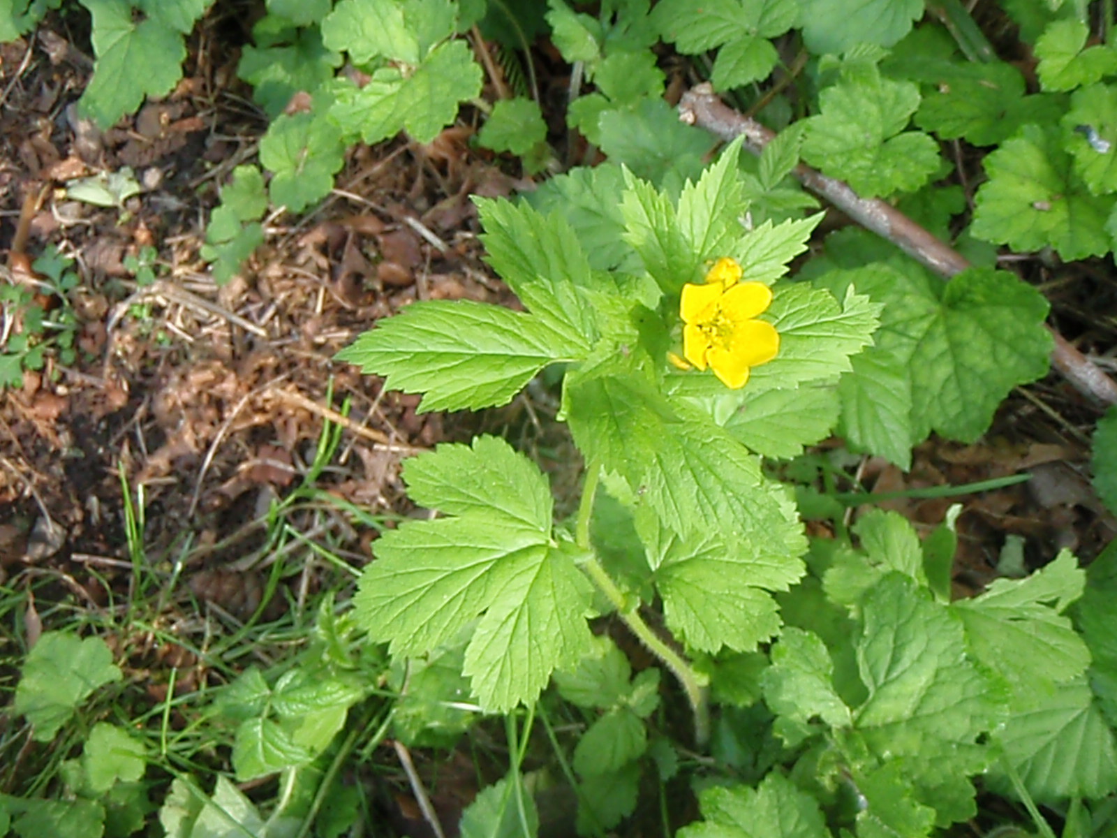
I really liked the plants that were in bloom this time of year at the park. Trillium, False Solomon's Seal, Flowering Cherry Trees, and possibly many more blooming plants along the trails. Unfortunately, I saw two major invasive species there; English Ivy and Sticky Willy. Also it is unfortunate that I was not surprised by these two invasive species being there as English Ivy has taken over many parts of Portland and Sticky Willy has spread across the Willamette Valley like the wildfire for the past ten years.


 The flowers above are Trillium and the change from white to purple before they wither and fall off.

 The plant above is False Solomon's Seal.

The flowers above belonged to a Flowering Cherry Tree

So if you plan on going to Mary S. Young State Park, bring your dog along as this is one park Fido can enjoy. Until next Saturday, get outside and enjoy one of the many state parks in the great Oregon Outdoors.

Thursday, April 25, 2013

Trail Talk Thursday #6

If you are one of the many people looking for a short hike to escape the city, then check out the short trail at Bonnie Lure State Recreation Area. At roughly a half hour drive west of Oregon City, this small park has a trail that takes you from a small parking lot to the side of Eagle Creek. Along the trail, you may notice blackberry and Salmonberry bushes. Many trees allow for a cooler climate below, and the shade is most welcome on a hot sunny day. I estimate the trail length to be about a tenth of a mile or so from one end to the other, so it can be a great place to go for hikers with bad joints. Once at the side of Eagle Creek you can enjoy the scenery while fishing for Steelhead (Rainbow Trout).


Oregon Grape


Blackberry


Salmonberry

Eagle creek

So if you're looking for a short hike in the mid-Willamette Valley, check out the trail at Bonnie Lure State Recreation Site. Until next time, get outside and and enjoy hiking on one of the many trails in the great Oregon Outdoors.

Wednesday, April 24, 2013

Waterfall Wednesday #5


North Falls

While this 13-foot waterfall isn't the highest in the park, it sure can be the loudest. Between early-Winter and mid-Spring, you can hear the booming noise of the waterfall pounding the rocks below it from a quarter mile away at the North Falls Viewpoint. With a short trail from the North Falls Parking Area, this waterfall is most likely one of the top five visited waterfalls within Silver Falls State Park. if you do decide to walk down to the cavern below North Falls, just remember that pets are not allowed on this section of trail.

As you walk behind the waterfall, you can see gaping holes in the rock, and if you look closely enough, you can see the sedimentary rock of the Vantage Interbed. Be careful when walking behind the waterfall as there still may not have any railing and the ground can be quite slippery.


The Geology of the North Falls
Below the trail is one solid layer of basalt that is 140-feet thick that came through the area between 16.5 and 15.6 million years ago. Above that layer, the part that has been hollowed out, is a sedimentary unit called the Vantage Interbed. Two more layers of rock that are at the top of North Falls are from basalt lava flows that came through the region between 15.2 and 14.5 million years ago. During the Ice Ages, water surged over this waterfall, creating the two gouge marks in the ledge, and several more within 40 feet upstream from this waterfall.


The History of the Upper North Falls
Several artifacts from the Kalapuya Tribe have been found under the cavern at North Falls. Perhaps the natives made a yearly pilgrimage to honor the creek. Or perhaps they were just dropped by a hunting party.


If you feel like viewing the North Falls, make sure you take appropriate gear if you go in winter, as there could be ice along the trail, and always check the Silver Falls State Park Website for information about trail closures during Winter. Until next time, get outside and enjoy hiking to one of the many waterfalls in the great Oregon Outdoors.

Tuesday, April 23, 2013

Native Talk Tuesday #5


The animal featured in today's Native Talk Tuesday is Sciurus griseus, commonly known as the Western Gray Squirrel. It's primary habitat seems be woodlands and are often seen in city parks and farms that have many old trees. The Western Gray Squirrel is easy to spot as it's tail hairs seem to be more fluffier than other gray squirrels.


The plant featured in today's Native Talk Tuesday is Poa bulbosa, commonly known as the Bulbous Bluegrass. The photo below was taken near the path in Erratic Rock State Park, north of the town  of Sheridan, Oregon. The Bulbous Bluegrass is an introduced species of grass that has purple bulb-like structures instead of spikelets. It is common in disturbed, relatively dry habitats at low elevations, and like most grasses, can be spread into undisturbed ground by animals and the wind carrying the seeds.


Unfortunately, due to the fact that taking plants from state parks is illegal, non-native species like this one are able to spread until they become a problem. If you do see a non-native species on state land and you want to do something about it, it is best to notify the agency that watches over that land. For more information and close-up pictures, I suggest this website: The University of Montana--Missoula: Northern Rockies Natural History Guide

Monday, April 22, 2013

Mountain View Monday #6

At 10,497 feet tall, this mountain was named after the US President that sponsored the Lewis and Clark Expedition. Before that, it was called Mount Vancouver by the British and Seekseekqua by the Natives in the region. As the second highest mountain in Oregon, it sits along the Cascade Range as a stratovolcano, seen from Central Oregon and the Mid-Willamette Valley. Like Mount Hood to the north, it has a national wilderness named after it.

Today's view of this mountain comes from the headwaters of the Metolius River near Camp Sherman.


As you might have guessed by now, the mountain is Mount Jefferson.

Sunday, April 21, 2013

Earth Speak Sunday #5

For today's Earth Speak Sunday, I present three quotes in honor of Earth Day 2013. For those that don't know, Earth Day 2013 is Monday, April 22 (tomorrow).

Ralph Waldo Emerson

The earth laughs in flowers.


The Four Seasons: Japanese Haiku by Hokushi

Experimenting...
I hung the moon
on various
branches of the pine


The Prophet by Kahlil Gibran

And forget not that the earth delights to feel your bare feet and the winds long to play with your hair


The flowers in the first picture are Ranunculus acris, commonly known as the meadow buttercup, tall buttercup, and giant buttercup. I believe that the squirrel in the second picture is the Western Gray Squirrel

Saturday, April 20, 2013

State Park Saturday #5

Everyone knows about the Ice Ages and probably know about the Ice Age Floods known as the Missoula Floods that broke through an ice dam, scoured the topsoil off most of eastern Washington, tore a gap through the Cascade Mountains (Columbia River Gorge) and continued out to sea. Few people know the whole story about the floods: they happened hundreds of times throughout the Ice Ages, the flood water backed up into the Snake River when it got to the eastern edge of the Columbia Gorge, and also backed up in the Willamette Valley. 

As you can see from the photo above, the hike to the rock is pet friendly.


When the floodwater backed up in the Willamette Valley, it created a
400-ft deep lake. Icebergs from the collapsed ice dam floated into parts of the valley, and as the water receded, those icebergs were set down when they bumped into a hill that kept them from flowing out. Some of those icebergs had rocks from Montana inside them; those rocks are now called glacial erratics.

That brings us to the state park featured today: Glacial Erratic State Park. With roadside parking long enough to hold four or five cars, this little-known state park does not have a fee to visit.

A quarter mile trail leads up to several glacial erratics, the largest thought to be 90 tons, provides a perfect place for a picnic that has a great view of the surrounding landscape. The 90-ton boulder is thought to be the largest glacial erratic in the Willamette Valley, is composed of a metamorphic rock called Argillite.


 The view from the top of the hill.

So if you plan on going to Erratic Rock State Park, remember to leave the rock alone for others to enjoy as it has been estimated the people have broken off about 70 tons over the past several thousand years. And who knows, there might be Native American archeological evidence in the area that shows the rock being used as a millstone or something else. Until next Saturday, get outside and enjoy one of the many state parks in the great Oregon Outdoors.

Thursday, April 18, 2013

Trail Talk Thursday #5

If you are looking for a place to get away and see some of the migrating birds at a place that has a great view of the countryside, look no further than the Baskett Slough National Wildlife Refuge. At this time of year you can see many of the migrating waterfowl in many of the marshes and fields. A short hike up to the Rich Guadagno Observation Platform  allows you to get a closer look at the Willamette Valleys' past. Aside from the many birds you will see, the trail to the platform takes you through Oak Savanna, where grasses, wildflowers, and Oaks show visitors how the landscape of Willamette Valley  would have looked like before the settlers came into the region.

At left are several hundred geese, at right is one of the many marshes around Baskett Butte

After taking in the view at the platform, a short hike on the Rich Guadagno Memorial Loop Trail will take you up into the Oak forest at the top of Baskett Butte. While hiking through this small patch of forest, you will see many ferns and wood sorrel that are often found in the Cascade and Coast Ranges. Seeing these shade-loving plants in an Oak forest is rather unique for the Willamette Valley, but a few muddy patches along the trail tell us that the top of this hill gets plenty of rain.

 Besides the view, both of these pictures show the Oak Savanna with many grasses, wildflowers, and Oaks.

The trail to the Rich Guadagno Observation Platform, as well as the Rich Guadagno Memorial Loop Trail are open year round. While Springtime might be great if you want to see the wildflowers, I have a feeling that late October would be great to take in the various colors that the Oak trees display.

So if you're looking for a short hike in the mid-Willamette Valley, check out the Rich Guadagno Loop Trail at Baskett Slough NWR. Until next time, get outside and and enjoy hiking, or biking, on one of the many trails in the great Oregon Outdoors.